
A powerful, interactive tool for overlaying data & map layers.
Xplorer is an innovative and interactive tool that optimizes work efficiency. It enables analysis, layering and presentation of data and information. Xplorer integrates Database Reports, Topographic Maps, Aerial Photos, Fire Insurance Maps, layers from the Physical Setting Report, and the Vapor Screening Tool (if ordered). Built-in features and tools provide address search, data filtering, measurement, customization, collaboration functionality, and ERIS’ Figure Creator tool, which can generate figures and photo logs. Also, ERIS Mobile seamlessly integrates your site visit findings to Xplorer for analysis and reporting. Xplorer accommodates custom large-area and linear reports for efficient review and analysis.
* Included with all database orders and packages
Key Features
> Overlay data and multiple images over current street layers.
> Switch between Street, Satellite, or Terrain base layers.
> Filter data sources and view only the desired data sources on the map.
> Look up specific addresses or keywords using the Search functionality.
> Calculate Distance and Area using the Measure Tool.
> Draw and/or add Comments directly to any layer, then print to PDF for easy sharing between colleagues and clients.
> Save Views with your drawings, measurements, notations, and filters.
> ERIS Mobile lets you easily conduct research on-site, then seamlessly integrates your findings to ERIS Xplorer for analysis.
> Figure Creator a new tool within Xplorer, generates made-to-order branded figures and photo logs.

Want to Get Started?
Questions about this product?
ERIS XPLORER OVERVIEW PDF
The power of layering
View the full detail of environmental records for your project site and facilitate analysis using layers of historical imagery, topographic maps and physical setting information. Also included in Xplorer is ERIS' Vapor Screening Tool – to assess the risks associated with vapor encroachment.
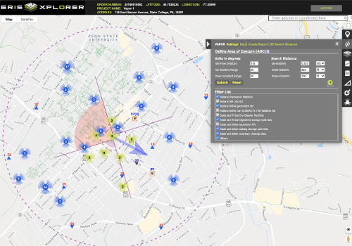
Vapor Screening Tool

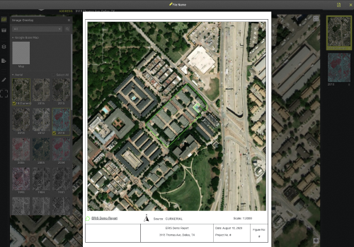
Figure Creator
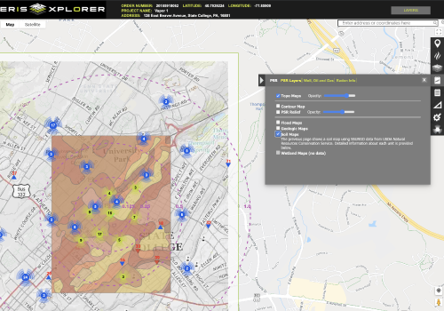
Physical Setting Report (PSR)
Want to learn more about ERIS Xplorer?
Connect with us to get more information about ERIS Xplorer or any other of our products and services for environmental due diligence.
Take a brief tour of this exciting new interactive tool for overlaying data and historical images.
Want A Quick Look at Other ERIS Tools?
ERIS has the most innovative and powerful due diligence tools in the industry.
Get to know our tools >>