Data Overload and How to Manage It
By Bill Leedham, P. Geo., CESA, QPESA
One of the most important tasks for any consultant working on a Phase 1 Environmental Site Assessment (ESA) is the research component. The primary purpose of the ESA is to determine actual or potential sources of environmental concern that may be associated with the subject Site, as well as surrounding and nearby properties, which typically involves looking at a lot of environmental databases. Sufficient relevant data must be reviewed to understand the site and area history, to assess current and historical activities, and to use this data to evaluate potential environmental issues.
“Not everything that can be counted counts; and not everything that counts can be counted.” Albert Einstein
Getting the ‘Right’ Data
Before one can accurately assess the data, you must determine what specific data searches are required, and balance those requirements with the availability (and costs) of such searches. This may vary with the type of ESA being conducted, the objectives of the ESA stakeholders, the geographic location and the applicable regulations governing the assessment. For example, when conducting ESAs in Canada, the Canadian Standards Association under CSA-Z-768-01 specifies mandatory and optional research items for Phase 1 ESA, which are sufficient for transactional due diligence. However when a Record of Site Condition (RSC) is required for a change in land use (in Ontario only) additional mandatory research items are required by the Ontario Ministry of the Environment Conservation and Parks under Ontario Regulation 153/04, as amended. A different set of data is required to complete the ESA process for an Upstream Oil and Gas site in Alberta, including site-specific records regarding drilling muds and oil well production. The consultant must therefore pre-determine the use and objectives of the ESA, and follow all the applicable regulatory requirements to properly complete the assessment. The Site locale can also influence the type and amount of information that is available. You can expect to spend extra time researching more databases for an urban setting than rural, and if you are looking at an old industrial property in a major city some records can go back over 150 years. Unique settings like First Nations land may yield less published data, with more information to be found in the community’s oral history; so the assessor will need to include appropriate consultation, communication, and interviews to gather their required data.
Getting the Data ‘Right’
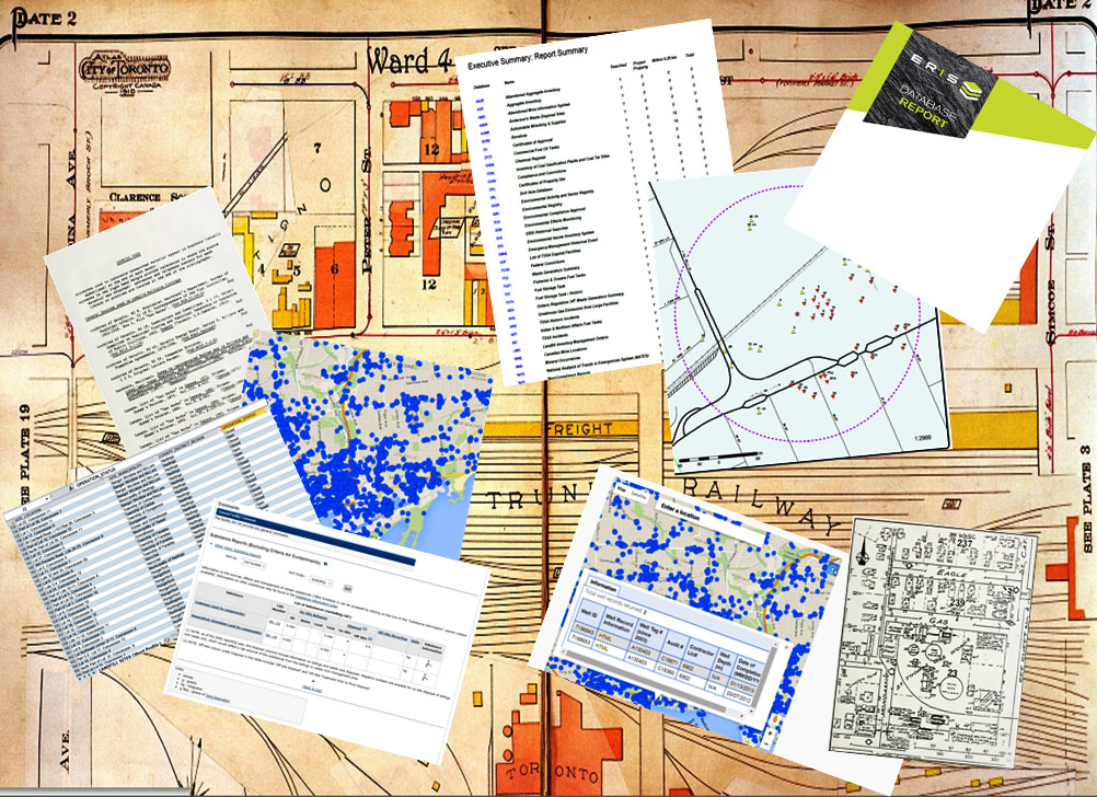
One of the best tools I have found for this research, and one I highly recommend in Phase 1 ESA training courses I teach for the Associated Environmental Site Assessors of Canada (AESAC’) is an environmental database report from Environmental Risk Information Services (ERIS). ERIS has been providing customized database reports to consultants, developers, insurers, municipalities and others in Canada since 1999 and in the USA since 2013; and ERIS reports are now available for Mexico, Australia, Germany and the United Kingdom. When determining ESA research requirements, or ordering an ERIS database you should always consider the following:
• Understand the ESA and client objectives, and follow the appropriate regulatory standards.
• Determine how far back your historical review must extend (i.e. when was the Site’s first developed use that could potentially impact the Site).
• Gather as much information as you can about current and prior site owners and occupants, and ensure you have a complete description of your Site (legal description, street address, geographic coordinates, and plan showing full extent of subject property).
• Determine the required search distances for your study area (both by regulation and to adequately assess environmental issues affecting your site).
• Relay all the appropriate and relevant information to your database administrator, or research provider, and follow up if there are any uncertainties.
• Conduct additional research as needed with the municipality, environmental regulator or other government agencies in order to validate records of interest or concern.
Common Problems with Environmental Databases
I have observed a number of problems with environmental databases in general, and database search providers like ERIS have also run into these issues; which can include:
• Incorrectly entered original data (e.g. incorrect GIS coordinates).
• Insufficient or inaccurate original data (e.g. incomplete provincial well records).
• Wrong municipal address is used for the data search (e.g. Main St North vs. Main Street South).
• Historical changes in Street names (e.g. Main Street formerly called King Street), or changes in municipal address numbering.
• Too many databases and too much data can lead to possible data conflicts (e.g. data reported in a private database; but not in a regulatory database).
• Missing reference data (i.e. what do certain codes signify).
• Government databases that are not regularly updated, or get deleted after a set period of time.
• Duplicate records, or out-of-date records that have not been updated at the source.
• Missing Unique Identifier for records – this makes it difficult to match records and identify records.
• Data still in paper copy or PDF which makes it difficult to extract the information.
• Absence of relevant data for the Site does not always mean there are no records, sometimes you have to double check in several databases.
• When no data is returned for a database search or information request; nil results are still reportable.
“Data! Data! Data! I can’t make bricks without clay!” Sir Arthur Conan Doyle
Avoiding Database Pitfalls
I asked Mike Chester and Carolyn Inglis of ERIS to walk me through the steps ERIS takes to confirm data and vet their information prior to plotting and reporting, and to avoid some of the problems noted above. Data is analyzed when first received by ERIS to understand the data model and to ensure all records requested have been provided from the source database. This includes confirming the accuracy and usability of the supplied coordinates, checking for missing data fields, and any available updates. All database information (particularly coordinates) is dependent on the accuracy and validity of the original data entry in the source database. Procedures and techniques such as address cleansing software, geocoding and manually reviewing data sets are employed to screen for incorrect addresses, alternate and historical street names or other potential errors. As a last step the Report Analyst looks at all records within a report to ensure all data is plotted correctly.
“True genius resides in the capacity for evaluation of uncertain, hazardous, and conflicting information.” Winston Churchill
It’s not enough to just obtain historical records or database information and include them as an appendix to an ESA report. A great deal of professional judgement is required to accurately assess the data and determine the reliability and relevance of the reported data with regards to the ESA property. Insufficient historical research, compounded by incorrectly interpreted data can lead to serious financial, legal and liability implications for the consultant, and for ESA proponents and other stakeholders.
Bill is the founder and President of Down 2 Earth Environmental Services Inc. and the Head Instructor and Course Developer for the Associated Environmental Site Assessors of Canada (www.aesac.ca). You can contact Bill at [email protected]. This article was originally published for AESAC as ‘The Instructors’ Blog.”