Your Leading
Property Due Diligence Resource
Unmatched Data, Historical Resources, Innovation, and Service
Making Your Work Life Easier
By providing the most current data, historical information and software solutions for environmental and property assessments in the United States, Canada, and Mexico.
Distinguished by our tireless dedication to data accuracy, innovation, as well as personal and responsive service.
Our workflow tools, applications, and SaaS solutions are designed around your needs.
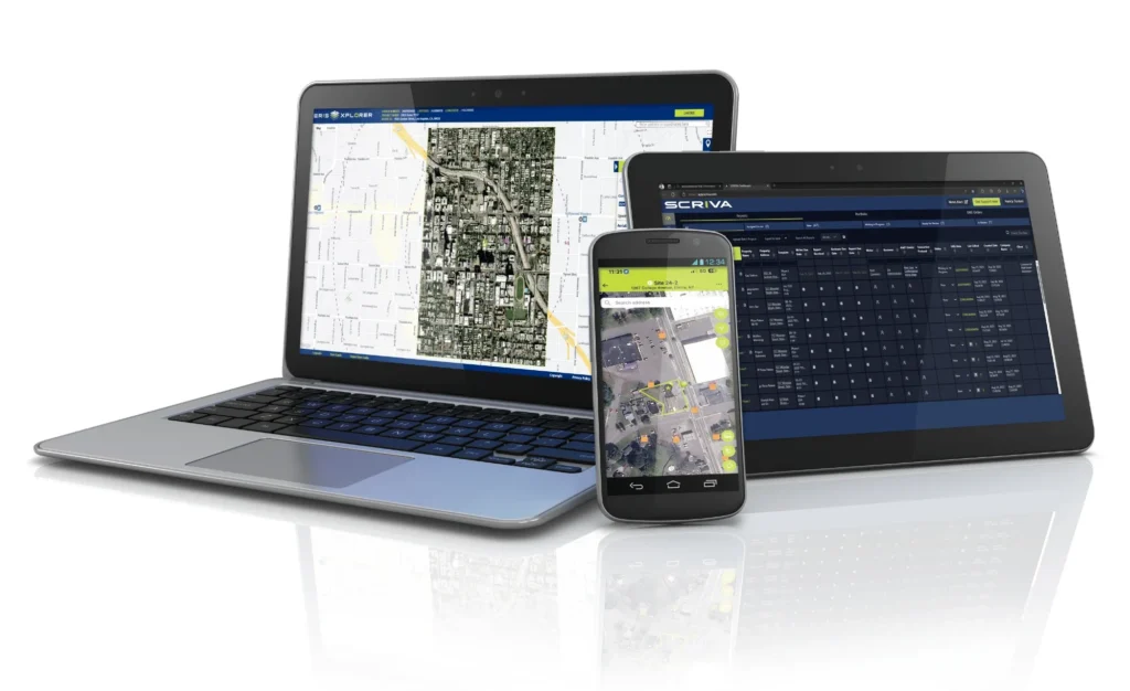
ERIS POWER SUITE
Property Due Diligence Solutions
Advanced technology for every stage of property assessment.


Our Products & Workflow Solutions
Discover our complete range of tools designed to support every stage of your commercial real estate due diligence and decision-making process.
Scriva
Scriva streamlines report writing, collaboration, document collection, and project management through ERIS’ workflow integration.Database Reports
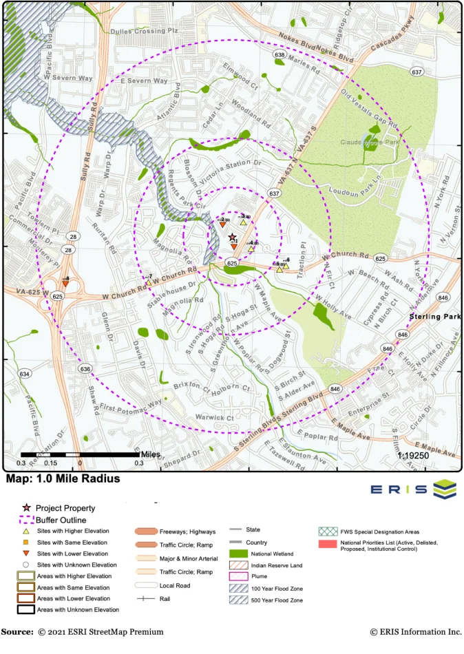
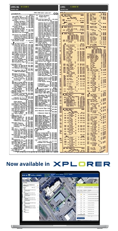
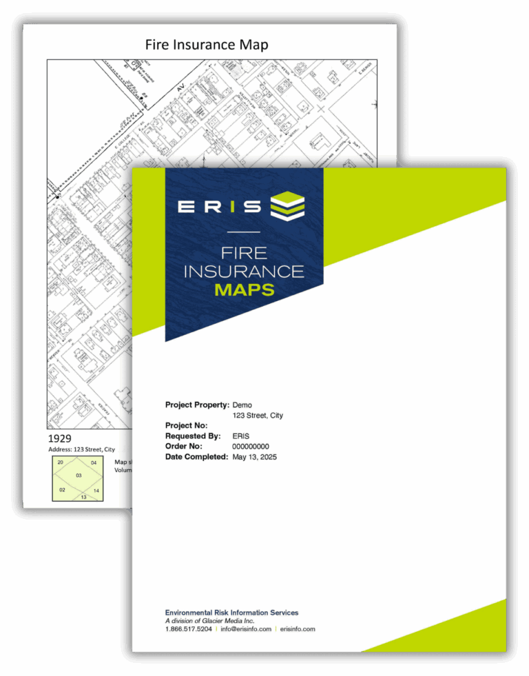
Key federal, state and proprietary databases are researched to identify environmental concerns associated with your subject property and surrounding area.Historical Aerials
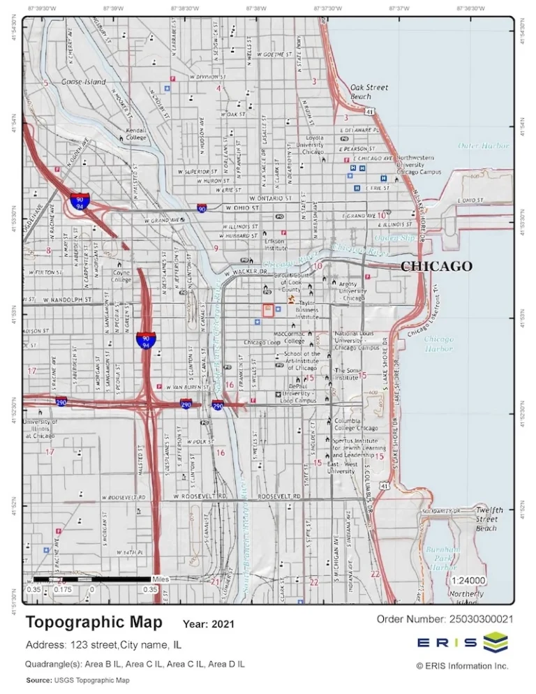
Historical Aerial Photographs depict the history of land use over time. They play an essential role in the historical review component of a Phase I ESA.NEPA Report
Evaluate potential effects on natural and cultural resources with confidence.


infoHUB
ERIS makes property due diligence easier.
Explore our tools and resources to stay ahead.

ERIS Originals
Blog
ERIS Originals Blog provides readers with thought-provoking insights from the industry’s top experts on property due diligence.

ERIS
Webinars
Unlock valuable knowledge you need to strengthen your environmental due diligence efforts through our library of webinars.

RISK-E Business
Podcast
Are you an environmental professional looking to stay up to date on the latest topics and issues related to environmental risk…

ERIS Updates
Our Industry News & Updates page is your one-stop destination for all the latest developments and trends shaping the work of environmental professionals.

ERIS Newsletter
ERIS Insider summarizes key news items and current trends shaping the work of environmental assessment and due diligence practitioners.

Learning Resources
New to ERIS? The Learning Resources page provides you with helpful information, instructional documents and tutorials to help you get started.
Contact Us
The ERIS team is here to help.