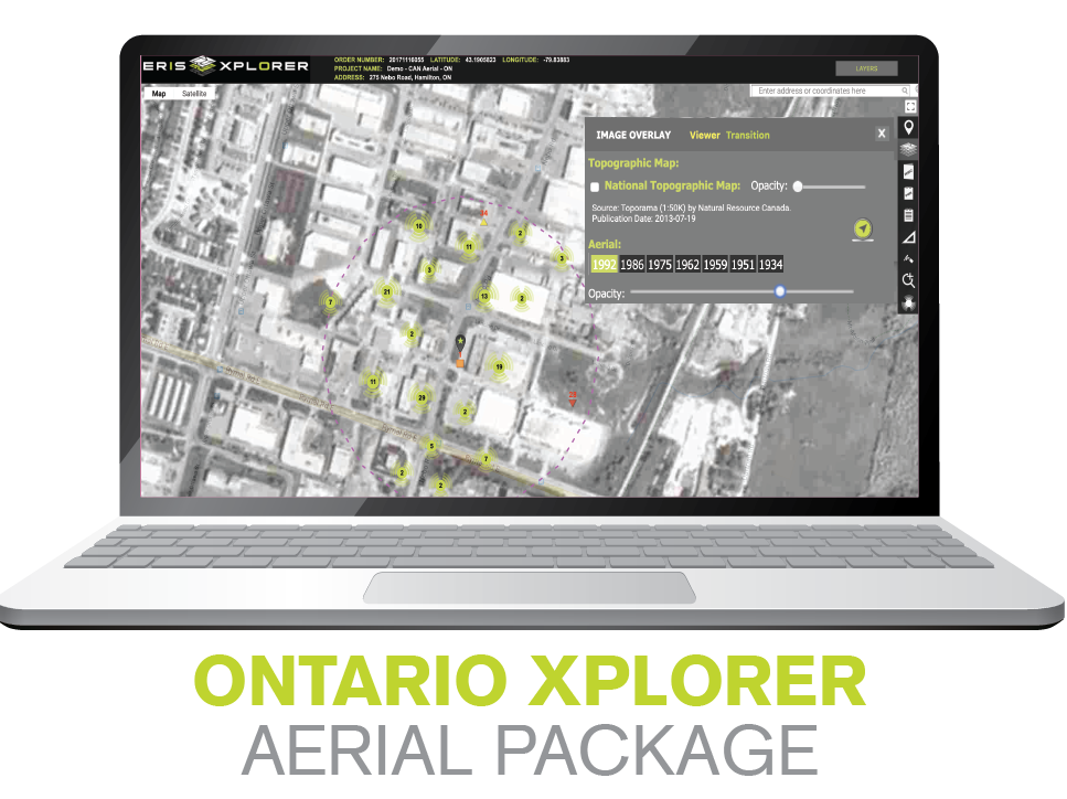
This package includes: a Standard Database Report, georeferenced Historical Aerials*, an Ontario Base Map (OBM) – all delivered and presented through ERIS Xplorer. Xplorer streamlines your ESA workflow – saving you time and money through more efficient data review and analysis. Review your environmental data and layer your historical aerials on one central platform.
*The ERIS Team selects the best aerial (coverage, scale and quality) for your site from each decade available.
If you haven't experienced Xplorer, and its ability to 'transition' the view of your site location through the decades, then please arrange a demo with us.
We would love to show you this powerful layering and analysis tool.
Email us or complete the adjacent form to schedule a demo.
Contact us for more information or to schedule a demo
Who uses ERIS for Environmental Assessments?
ERIS XPLORER Brief Tour
Take a brief tour of this exciting new interactive tool for overlaying data and historical images.