Historical Products & Tools
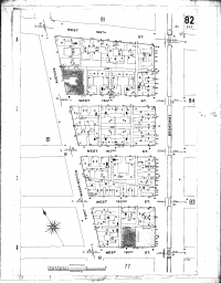
Fire Insurance Maps
$135 (with Database Report only)
Fire Insurance Maps were first published in the mid-1800s. These maps show details of urban and industrial areas such as roads, building footprints, building construction details, location of storage tanks, the building use at the time the map was prepared and the names of the building occupants. From these maps you can note the location of wells, raw material storage locations and the locations of storage tanks containing chemicals and petroleum products.
ERIS has a collection of close to 1 million historic Fire Insurance Maps covering many areas of the United States. Fire Insurance Maps may be purchased along with a database report or as part of a package.
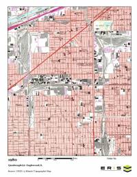
Topographic Maps
$95 per set of maps
ERIS’ topographical maps were first published in the late 1800s and now cover the entire United States. Topographic maps show natural features such as wooded areas, lakes, rivers, wetlands and topographic relief. Cities and towns are depicted along with individual structures in rural areas and man-made structures such as roads, railroad tracks, dams and bridges. Certain land disturbance activities such as quarries, mines and ditches, which may have environmental research importance are often shown.
- ERIS provides digital copies of current and historical 7.5- and 15-minute USGS topographic maps for the entire United States.
- All topographic maps are in color and include a scale bar and the year created/updated.
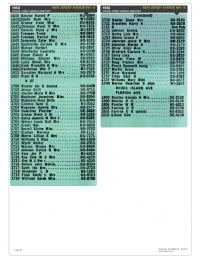
City Directories
$115 for two streets $95 for one street
City directories are valuable historical data sources for identifying past occupants of buildings over long periods of time. ERIS has a research team of experts located at multiple research facilities throughout the country. As available, ERIS will provide digital images for your property or address range.
Research Parameters
- City directory covers your site at approximate five year intervals.
- Specify which additional street you would like ERIS to research or we will select the street for you based on the information you provide.
- An ERIS representative will contact you if we discover conflicting or incomplete information regarding your site location and the streets to be researched.
- For many older cities, city directory coverage can date back to the early 1900s.
- Custom city directories can also be searched. Please contact us for more details.
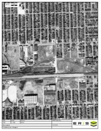
Historical Aerials
$95 per set
ERIS provides Historical Aerials either as a single purchase or as part of a package of environmental and historical information. ERIS works with suppliers to provide excellent quality Historical Aerials depicting the history of land use over time. They are also used to determine where to drill and sample during Phase II projects.
Highlights of Historical Aerial Photos:
- Most of the aerials have a scale of 1” = 500’ with a few at 1” = 800’.
- Each aerial photograph can show an area up to 5000’ x 7500’ or approximately 860 acres in size, dependent on the shape of the property. Larger sites or irregularly shaped sites may require more aerial photographs at an additional charge.
- ERIS will provide 5 to 12 historical aerial photographs of different years typically ranging from the 1930s or 1940s to the near present.
- Historical Aerials are offered a la carte and in ERIS’ multi-product packages.
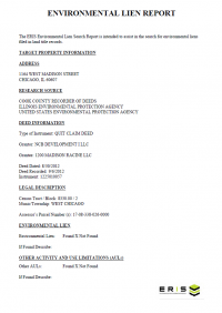
Environmental Lien Search Report
$125 per parcel
Environmental Lien is defined as: A charge, security, or encumbrance upon title to a property to secure the payment of a cost, damage, debt, obligation, or duty arising out of response actions cleanup, or other remediation of hazardous substances or petroleum products upon a property, including (but not limited to) liens imposed pursuant to CERCLA 42 USC 9607(1) and similar state or local laws.
To create an Environmental Lien Search Report, a network of professional, trained researchers, following established procedures, uses client supplied property information to:
- Search for parcel information and/or legal description;
- Search for ownership information;
- Research official land title documents recorded at jurisdictional agencies such as recorder’s office, registries of deed, county clerks’ offices, etc.;
- Access a copy of the deed;
Search for environmental encumbering instrument(s) associated with the deed; - Provide a copy of any environmental encumbrance(s) based upon a review of key words in the instrument(s) (title, parties involved and description); and
- Provide a copy of the deed or cite documents reviewed.
If ordering an Environmental Lien Search Report with more than one address, parcel number, Lot/Block, legal description, etc., each will be charged as a separate search. They may not follow the same chain. If your client expects to pay for only one search, please choose one address, parcel number, Lot/Block, legal description, etc.
1-5 business day turnaround time (multiple parcel searches may require additional time)
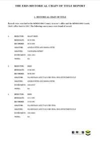
60-Year Historic Chain of Title Report
$315 per parcel
A search for a property’s previous owners of a certain piece or parcel of land, typically going back to 1940, showing recorded date, grantor, grantee, and recorded instrument information. A copy of the current vesting deed can be included if requested at time of order.
If splits occur (ex: current parcel was assembled from 2 or more parcels back in the 1960s), additional costs to be approved before work continues. Time required to receive approval for additional splits is not included in turnaround time. Splits must have a common back chain. Multiple chains also occur when partial interests are conveyed to multiple parties. For example, if an owner conveys 1/20 interest to ten separate owners, then each one of those ten owners has a separate ownership chain until a single party assembles them.
If ordering a Chain of Title with more than one address, parcel number, Lot/Block, legal description, etc., each will be charged as a separate search. They may not follow the same chain. If your client expects to pay for only one search, please choose one address, parcel number, Lot/Block, legal description, etc.
7-10 business day turnaround time (multiple parcel searches may require additional time)
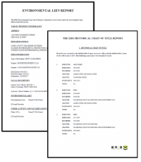
Lien & Title Bundled Property Report
$325 per parcel
Environmental Lien Search Report & 60-Year Historic Chain of Title Report
Together the environmental lien search report and historic chain of title report provide the most detailed information on the history of ownership and financial status of a property.
If ordering with more than one address, parcel number, Lot/Block, legal description, etc., each will be charged as a separate search. They may not follow the same chain. If your client expects to pay for only one search, please choose one address, parcel number, Lot/Block, legal description, etc.
7-10 business day turnaround time (multiple parcel searches may require additional time)

Permit Timeline Report
$25 per address
This report provides a complete picture of property risk with detailed insight into a property's condition and history. Get instant access to building permitted work and details, including job cost, permit type, contractor details and more, for all major systems.
- Permit searches are performed based on the single address input, and proper/legitimate address format is critical.
- The report can be ordered a la carte (under the PRODUCTS' tab) on the online order form.
- Results will be uploaded to Xplorer and/or Quire and delivered instantly for download from the 'My Orders' page.
Reliable and constantly updated data
Get in touch with us
Click here to request a demo. One of our Regional Account Managers will contact you immediately.
Want to learn more about or Historical Products?
Connect with us to get more information about our Historical Products & Tools or any other of our products and services for environmental due diligence.