Whether or not you're new to Phase I ESAs…
START YOUR RESEARCH HERE:
A resource page for SAVING TIME
on your environmental due diligence research.

What is a Phase I Environmental Site Assessment (ESA) Report?
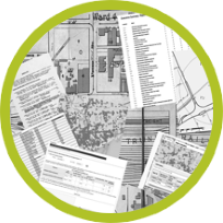
A Phase I ESA is a detailed site report prepared for a real estate holding or property, typically before purchase, transfer, or development. The analysis addresses a wide variety of environmental risk factors, and should cover both the land itself, and property developments over time.
What Does a Phase I ESA Report Contain?
The Phase I report highlights known or potential environmental contamination liabilities or environmental risks. Its goal is to provide as much information as can be discovered through research and often includes records of previous land usage, aerial and historical photos, natural topographic features, potential soil contamination and groundwater quality, potential chemical residue, prohibited building materials, or hazardous substances.
Are All Phase I ESA Reports the Same?
The scope of the Phase I ESA report may vary according to client needs, and also to industry standards for different situations. In general, having more complete and in-depth research markedly improves the quality of the report. This in turn dramatically reduces the risk of finding problems later. Unfortunately, many companies have regretted not doing a thorough Environmental Site Assessment Report resulting in lawsuits, large payouts,
or worse.

What Does the Phase I Environmental Report Not Include?
The Phase I ESA does not typically include soil samples or any “boots on the ground" examination. Most of the information in the Phase I report can be gathered without going to the physical site, but rather through the Internet and specialized tools. Instead, detailed, site specific information is taken from historical records, photographs, deeds, and even satellite images. In some cases today, drone video footage and drone sensor data may
also be used.
Tools for Faster Phase I ESA Completion
In the past, Phase I ESA research could take weeks to perform and be incredibly time consuming. But now, new tools make it easy by bringing together large amounts of complex environmental risk information in one place.
Fortunately, today you can order large data packs of information from one source and even use 3D visual and mapping tools like ERIS Xplorer to see how a plot has changed over time.

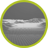
ERIS Xplorer
Xplorer’s visual map interface lets you see your plot and all associated visual, landscape, and numerical environmental data – both today and in the past. ERIS XPLORER is an add-on tool when ordering environmental data from ERIS. It lets you see your location in a map interface and even overlaying topographic, photographic, and other map layers. Quickly find your plot location based on address or company name. You can then see all of the records associated with that area, or even watch it change over time.

Physical Setting Report (PSR)
Want a complete set of key environmental information in one tidy package? The Physical Setting Report or PSR saves you time by providing a large set of information about a site and the surrounding area. The report typically includes a complete overview of topography as well as geologic, hydrologic, and soil characteristics, as well as detailed attributes of water wells, oil and gas wells, radon measures, and other important environmental features.

Vapor Screening Tool
Vapor encroachment can create significant liability for a property and have adverse effects on human health. That’s why ERIS has created a tool dedicated specifically to assessing the risks associated with this condition/risk. The ERIS Vapor Screening Tool helps identify a Vapor Encroachment Condition (VEC) as part of a Phase I Assessment (complying with ASTM E2600-15).
Figure Creator
Quickly create made-to-order, branded Figures and Photo Logs for your environmental due diligence reports. Within Xplorer, just click on the Figure Creator tool, and then you can prepare, crop, annotate, title, customize and save/generate the images you want. Figure Creator has several built-in templates that you can brand with your company logo and then incorporate your customized figures and photo logs.

ERIS Mobile
The new ERIS Mobile app allows you to perform efficient and effective site visits in order to complete your environmental due diligence on properties. The app interactively displays a base map layer, ERIS-provided regulatory records and historical products related to a project, as well as captures photos, field notes, and enables the completion of a standard or customized site visit checklist. The map layers (if ordered) include Historical Aerials, Topographic Map, and Fire Insurance Maps.

ERIS Direct
Blazing fast, always-on tool for preliminary Phase I research exploration. Designed for companies that do a lot of real estate and environmental risk analysis ERIS Direct gives you on-demand access to environmental data. While not built to fulfill an ASTM-compliant Phase I like our Database Reports and ERIS Xplorer, ERIS Direct is the fastest way to quickly gather comprehensive information most environmental consultants use to make preliminary decisions about property risk.
Revised E1527 Standard Practice Anticipated for 2021
The Task Group has set up several smaller focus groups to discuss and present suggested modifications for some key elements, such as:
- Strengthening the historical research and site visit documentation
- Better handling of significant data gaps
- Updating the database requirements
- Streamlining the report format
Compliance Requirements & Standards
ERIS property record and database packages are based on ASTM standard compliance. These standards include a review of all adjoining properties to the property being researched. ERIS tools offer a built-in Google Map feature to allow users to zoom in or out to see other properties in the target area.
What is ASTM International?
ASTM International sets standards for many types of real estate due diligence assessment. These standards are used by most major development, lending, and investment companies. As one of the largest voluntary standards development organizations in the world, ASTM International creates standards for a wide variety of industries
including environmental risk management. Active in over 140 countries, ASTM's standards guides are the product of a worldwide braintrust, and are known throughout the world.
HOW TO PURCHASE ASTM GUIDES FOR PHASE I ASSESSMENTS AND REAL ESTATE DUE DILIGENCE:
Standard Practice for Environmental Site Assessments: Phase I Environmental Site Assessment Process
(ASTM-E1527)
Standard Practice for Limited Environmental Due Diligence: Transaction Screen Process
(ASTM-E1528)
Standard Guide for Identifying and Complying With Continuing Obligations
(ASTM-E2790)
Online and Self-Guided Training
ASTM’s elearning programs give you access to on-demand courses. Employees can train at their own pace and companies can track and evaluate employee progress.
Live and Onsite Training
The ASTM offers training courses at centralized locations around the country.
Detailed Review and Comparison of the ASTM and CSA Standards
Need information for Canada-US border transactions? Cross-border transactions involving companies with commercial and industrial properties in the US and Canada are occurring with increasing frequency. Lenders, consultants and lawyers are often called upon to review reports prepared under standards of either, or both, jurisdictions. The CSA standard for Phase I ESAs in Canada was developed by the Canadian Standards Association, now known as CSA Group. While there are some differences, there are a great many similarities between the ASTM E1527 standard for Phase I Environmental Site Assessments for Commercial Properties in the US and CSA Z768-01 standard for Phase I ESAs in Canada.
JOIN THE DISCUSSION WITH ERIS’ LINKEDIN CLIENT FORUM!
Join ERIS’ LinkedIn private Client Forum to learn about the latest trends, share information with other trusted advisors and stay in the lead!
MORE PHASE I HELP AND SUPPORT!
ERIS is here to make your next Phase I ESA Easier